Waypoints: measuring a route around obstacles
A straight-line ruler answers "how far is it" honestly only when nothing is in the way. The moment a pillar, a corner or a wall sits between two points, the straight-line number is wrong in the direction that matters — it understates the distance a creature would actually have to cross.
· 4 min read · TerrainTale
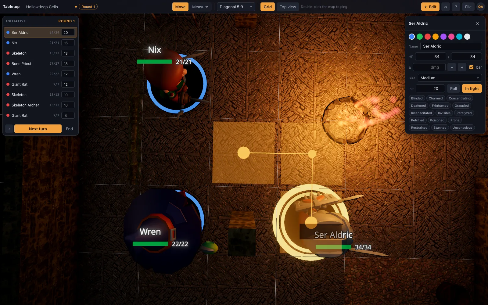
The problem with a straight ruler
Drag a ruler straight from a rogue to a target on the far side of a support column and the readout will happily report a distance that runs straight through solid stone. It's a fine answer to a geometry question and a wrong answer to the question anyone at the table actually asked, which was whether the rogue can reach the target by a path that exists.
The fix is not a smarter ruler that automatically routes around every obstacle — that would guess at a path nobody chose — it's a way to say which path you mean.
Adding a waypoint mid-drag
Press Space, or right-click, in the middle of a drag to drop a waypoint, then continue the drag toward the actual target. The readout adds up the legs of the route through each waypoint rather than the straight line between the start and end points, so a route around a pillar or around a corner is measured as what it actually is: two or more straight legs, not one that cuts through the wall.
This is the same mechanism whether you're measuring with the standalone ruler (M) or dragging a mini to move it — a waypoint mid-drag routes either one.
When it's worth the extra click
Most measurements on a table don't need a waypoint — an open room has nothing to route around, and the straight-line number is the right one. Waypoints earn their keep specifically when geometry is in the way: a pillar in the middle of a chamber, an L-shaped corridor, a doorway that isn't on the direct line between two points. In those cases the extra click is the difference between a number the table can trust and one it has to argue about.
Works with your table's rules the same way
A waypointed route still follows whichever diagonal rule and elevation readout your table has set — the total is added leg by leg using the same rule, so routing around an obstacle doesn't quietly switch to a different way of counting squares partway through the measurement.
A concrete example
Picture a round chamber with a thick support column dead center, a rogue on one side and a fleeing target on the other. A straight-line ruler across the room might report 25 feet, which is a fine number for a path that doesn't exist — the column is in the way. Drop a waypoint at the edge of the column on the way past it, on whichever side actually has room to move, and the readout instead reports the two real legs of the route, which will honestly come out longer than the straight line. That's the number worth knowing before committing an action to the chase.
The same trick applies to doorways that sit off the direct line between two points, to an L-shaped corridor, or to any chamber where the shortest path on paper isn't the shortest path a creature could actually walk.