Measuring elevation in 3D combat
An archer on a wall, a rogue climbing to a ledge, a spell that needs a clear line up to a flying creature — every one of these is a height question, and a flat map answers it with a number scribbled in the corner and a promise to remember it. A 3D table just measures the height, because the height is actually there.
· 5 min read · TerrainTale
Why height is a separate number
Horizontal distance and vertical distance answer different questions at the table: how far a creature has to move, and how far up or down it has to go to get there. Folding both into one flat number loses information a DM and players actually need — whether a move includes a climb, whether a shot has to clear an obstacle, whether a fall is 5 feet or 30.
Keeping them separate, reported together, gives both answers without asking anyone to do the subtraction themselves.
The readout: "30 ft · 10 ft up"
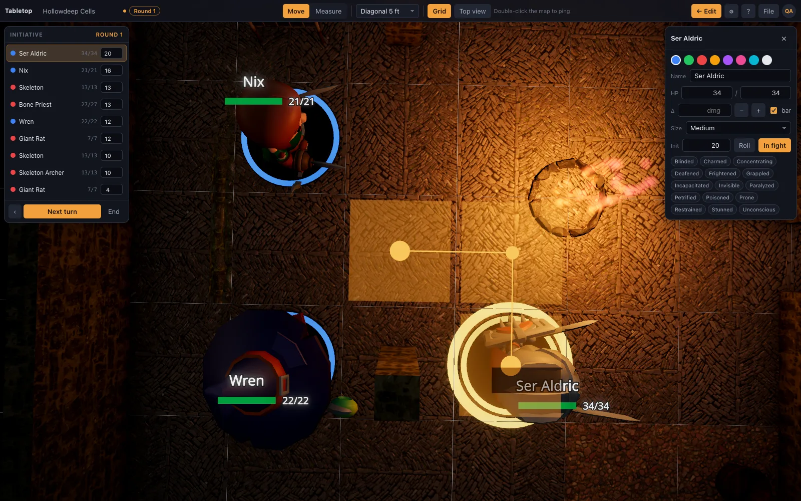
The elevation-aware readout reports distance and height together — an archer on a parapet, a pit trap, a flying creature — so the number is "30 ft · 10 ft up" rather than a flat distance that quietly ignores the climb. It updates live as a mini or the ruler is dragged, the same way the horizontal distance does.
That single readout answers two questions a table usually asks separately: is the target in range, and does reaching it involve height at all. On a flat map those are two different lookups; here they're the same drag.
What a flat map has to fake
A printed or flat digital map represents height with a number written next to a token, a stack of colored rings, or a DM's memory — none of which update as a fight moves, and all of which depend on someone maintaining them correctly. A ledge, a pit, a flying creature: each needs its own workaround, and each workaround breaks the same way, by falling out of sync with what actually happened on the map.
On a table built in three dimensions, the ledge is a real ledge at a real height and the pit is a real hole in the floor — there is nothing to fake, because the geometry the ruler measures is the same geometry everyone is looking at.
How it fits the diagonal rule
Elevation is read out alongside whichever diagonal rule your table has set — every diagonal costs 5 ft, the DMG's 5/10/5 variant, or true distance — and it is where true distance earns its keep most clearly: a diagonal climb to a ledge is a genuinely three-dimensional path, and true distance is the one rule of the three built to measure that honestly rather than approximate it.
The encounters where this actually shows up
Elevation stops being a footnote the moment a fight has any vertical structure at all: a watchtower with archers on top, a dungeon with a pit trap in the floor, a dragon that lands on a ledge instead of the ground, a rope bridge over a chasm. Every one of those puts a real distance question in front of the table that a flat map can only answer by writing a number somewhere and trusting everyone to remember it applies.
On a table built in three dimensions, the archer really is up on the tower and the pit really is a hole in the floor, so the elevation reading isn't a rule bolted on top of the map — it's just what the ruler finds when it measures the two points it's been asked to measure.